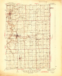
1944 Map of Milford
USGS Topo · Published 1944About this map
Milford serves as the primary hub of this eastern Illinois landscape, situated at the junction of Sugar Creek and the Chicago and Eastern Illinois railroad lines. The surrounding terrain is defined by a dense network of early rural education and community life, marked by dozens of small country schools such as White College Sch, Newbold Sch, and New Gothic Sch. The abundance of these schoolhouses, often spaced just a few miles apart, reflects a period of localized agrarian society before the consolidation of rural districts.
Find a feature on this map
64 named features on this map. Tap any name to fly to it.
Don’t see what you’re looking for? This feature index may not catch every label — zoom into the map to look around manually.
Map Details
Editions of this 1944 Milford Map
2 editions found
Other maps of this area

1933 · Hoopeston
USGS Topo · 1:48,000

1935 · Watseka
USGS Topo · 1:48,000

1936 · Potomac
USGS Topo · 1:62,500

1938 · Milford
USGS Topo · 1:48,000

1938 · Hoopeston
USGS Topo · 1:62,500

1939 · Watseka
USGS Topo · 1:62,500

1939 · Cissna Park
USGS Topo · 1:62,500

1944 · Milford
USGS Topo · 1:62,500

1944 · Gilman
USGS Topo · 1:62,500

1946 · Gilman
USGS Topo · 1:62,500