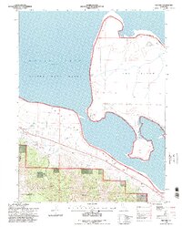
1994 Map of Milford
USGS Topo · Published 1998About this map
Honey Lake dominates this 1990s landscape, bordering the expansive Sierra Army Depot and the eastern edge of the Plumas National Forest. The settlement of Milford sits along the shoreline in Honey Lake Valley, where local landmarks like the Cem and Milford Creek reflect the town's established presence between the water and the rising terrain of the Mono Mountains.
Find a feature on this map
25 named features on this map. Tap any name to fly to it.
Don’t see what you’re looking for? This feature index may not catch every label — zoom into the map to look around manually.
Map Details
Editions of this 1994 Milford Map
2 editions found
Other maps of this area

1886 · Honey Lake
USGS Topo · 1:250,000

1891 · Honey Lake
USGS Topo · 1:250,000

1893 · Honey Lake
USGS Topo · 1:250,000

1950 · Milford
USGS Topo · 1:62,500

1954 · Wendel
USGS Topo · 1:62,500

1954 · Litchfield
USGS Topo · 1:62,500

1954 · Doyle
USGS Topo · 1:62,500

1955 · Westwood
USGS Topo · 1:250,000

1958 · Westwood
USGS Topo · 1:250,000

1959 · Westwood
USGS Topo · 1:250,000