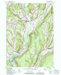
1943 Map of Milford
USGS Topo · Published 1994About this map
The Susquehanna River carves a deep valley through Otsego County, anchoring a landscape defined by small river-bend settlements and upland farming communities. At the center of the sheet, the village of Milford serves as a local hub where valley roads converge. To the south, the river widens significantly as it enters Goodyear Lake, passing the waterfront community of Cliffside. The eastern half of the map is dominated by the steep ascent of Crumhorn Mountain, which separates the Susquehanna from the Schenevus Creek drainage.
Find a feature on this map
40 named features on this map. Tap any name to fly to it.
Don’t see what you’re looking for? This feature index may not catch every label — zoom into the map to look around manually.
Map Details
Editions of this 1943 Milford Map
4 editions found
Other maps of this area

1907 · Cooperstown
USGS Topo · 1:62,500

1909 · Cooperstown
USGS Topo · 1:62,500

1909 · Delhi
USGS Topo · 1:62,500

1910 · Hartwick
USGS Topo · 1:62,500

1911 · Delhi
USGS Topo · 1:62,500

1912 · Hartwick
USGS Topo · 1:62,500

1915 · Oneonta
USGS Topo · 1:62,500

1918 · Oneonta
USGS Topo · 1:62,500

1943 · Mt Vision
USGS Topo · 1:24,000

1943 · Milford
USGS Topo · 1:24,000