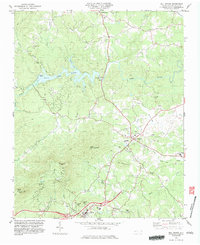
1982 Map of Mill Spring
USGS Topo · Published 1983About this map
Lake Adger and the Green River form the geographical heart of this Polk County landscape during the early 1980s. The reservoir, with its distinct Jackson Cove and the nearby Powerplant, supports local infrastructure alongside the growing communities of Mill Spring and Columbus. The map reveals a transition from traditional valley agriculture to more modern development, evidenced by the large Polk Central Sch and an extensive road network featuring sections marked as Under Construction.
Find a feature on this map
50 named features on this map. Tap any name to fly to it.
Don’t see what you’re looking for? This feature index may not catch every label — zoom into the map to look around manually.
Map Details
Editions of this 1982 Mill Spring Map
2 editions found
Other maps of this area

1907 · Saluda
USGS Topo · 1:125,000

1935 · Batcave
USGS Topo · 1:24,000

1935 · Fishtop
USGS Topo · 1:24,000

1946 · Bat Cave
USGS Topo · 1:24,000

1946 · Cliffield Mtn
USGS Topo · 1:24,000
1947 · Bat Cave
USGS Topo · 1:24,000

1947 · Cliffield Mtn.
USGS Topo · 1:24,000

1955 · Knoxville
USGS Topo · 1:250,000

1957 · Knoxville
USGS Topo · 1:250,000

1959 · Lake Lure
USGS Topo · 1:62,500