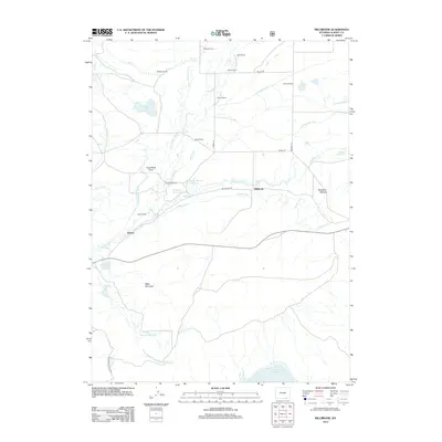
2012 Map of Millbrook
USGS Topo · Published 2012About this map
The Little Laramie River winds through this section of Albany County, where the landscape is defined by an extensive network of irrigation infrastructure and established family ranching operations. Significant water management features like the Stewart Canal, Mammoth Ditch, and Albany Ditch redirect water across the plains to support local agriculture and fill the Millbrook Reservoir Number 1. Small settlements and naming conventions reflect a deep history of land use, with numerous properties identified such as McGill Ranch, Forbes Ranch, and Croonberg Ranch. To the south, the terrain rises toward Table Mountain and the Lake Hattie Reservoir, while the community of Hatton sits near the riverbanks. This 2012 survey illustrates the enduring relationship between the high plains hydrology and the historic ranching legacy of the region.
Find a feature on this map
40 named features on this map. Tap any name to fly to it.
Don’t see what you’re looking for? This feature index may not catch every label — zoom into the map to look around manually.
Map Details
Editions of this 2012 Millbrook Map
This is the sole edition of this map. No revisions or reprints were ever made.
Other maps of this area

1895 · Laramie
USGS Topo · 1:125,000

1902 · Laramie
USGS Topo · 1:125,000

1905 · Laramie
USGS Topo · 1:125,000

1906 · Medicine Bow
USGS Topo · 1:125,000

1906 · Laramie
USGS Topo · 1:125,000

1908 · Laramie
USGS Topo · 1:125,000

1908 · Medicine Bow
USGS Topo · 1:125,000

1954 · Cheyenne
USGS Topo · 1:250,000

1954 · Rawlins
USGS Topo · 1:250,000

1958 · Rawlins
USGS Topo · 1:250,000