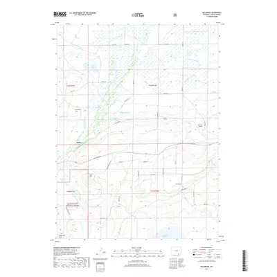
2017 Map of Millbrook
USGS Topo · Published 2017About this map
The Little Laramie River meanders through this portion of Albany County, defining a landscape heavily shaped by early 21st-century water management and ranching. The small settlements of Hatton and Millbrook sit amidst an intricate network of irrigation systems, including the Bellamy Ditch, Mammoth Ditch, and Stewart Canal. These waterworks supported the high-altitude agricultural operations of the Laramie Plains, funneling resources toward larger bodies like the Lake Hattie Reservoir and the twin Millbrook Reservoirs. To the south and west, the terrain rises toward Table Mtn and the edge of the Medicine Bow National Forest. This survey captures the modern ranching era, where legacy place names like Swedes Cabin-Lake and Croonberg Draw persist alongside newer rural developments accessed by roads such as Wild Horse Ranch Rd and Trailblazer Rd.
Find a feature on this map
53 named features on this map. Tap any name to fly to it.
Don’t see what you’re looking for? This feature index may not catch every label — zoom into the map to look around manually.
Map Details
Editions of this 2017 Millbrook Map
This is the sole edition of this map. No revisions or reprints were ever made.
Other maps of this area

1895 · Laramie
USGS Topo · 1:125,000

1902 · Laramie
USGS Topo · 1:125,000

1905 · Laramie
USGS Topo · 1:125,000

1906 · Medicine Bow
USGS Topo · 1:125,000

1906 · Laramie
USGS Topo · 1:125,000

1908 · Laramie
USGS Topo · 1:125,000

1908 · Medicine Bow
USGS Topo · 1:125,000

1954 · Cheyenne
USGS Topo · 1:250,000

1954 · Rawlins
USGS Topo · 1:250,000

1958 · Rawlins
USGS Topo · 1:250,000