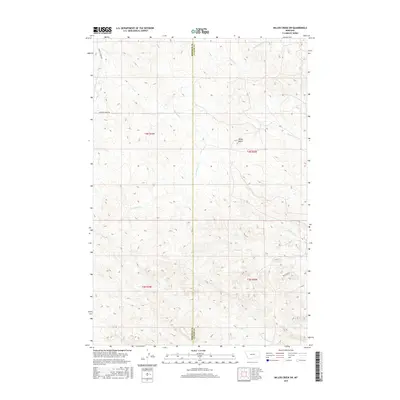
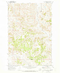
2017 Map of Miller Creek SW
USGS Topo · Published 2017About this map
Baldy Butte serves as a central topographical landmark in this 2017 survey of the borderlands between Rosebud and Custer counties. The landscape is defined by a dense network of intermittent watercourses, including the diverging paths of N Miller Cr and S Miller Cr that cut through the eastern townships. This modern topographic map illustrates the enduring isolation of the area, where human infrastructure is largely limited to unpaved access routes like Sweeney Creek Rd and Redstone Dr. The drainage patterns, from Sweeney Cr in the west to the headwaters of Pump Cr and Cow Cr in the south, provide a detailed look at the hydrology of the Big Horn Basin. For those tracking land use and ranching boundaries, the map clearly delineates the survey townships of t4n r44e and t4n r45e, showing the transition between these two prominent Montana counties.
Find a feature on this map
17 named features on this map. Tap any name to fly to it.
Don’t see what you’re looking for? This feature index may not catch every label — zoom into the map to look around manually.
Map Details
Editions of this 2017 Miller Creek SW Map
This is the sole edition of this map. No revisions or reprints were ever made.
Other maps of this area

1954 · Hardin
USGS Topo · 1:250,000

1954 · Forsyth
USGS Topo · 1:250,000

1957 · Hardin
USGS Topo · 1:250,000

1957 · Forsyth
USGS Topo · 1:250,000

1958 · Forsyth
USGS Topo · 1:250,000

1958 · Hardin
USGS Topo · 1:250,000
1969 · Moon Creek School
USGS Topo · 1:24,000
1969 · Miller Creek
USGS Topo · 1:24,000
1969 · Miller Creek SW
USGS Topo · 1:24,000
1969 · Miller Creek NW
USGS Topo · 1:24,000