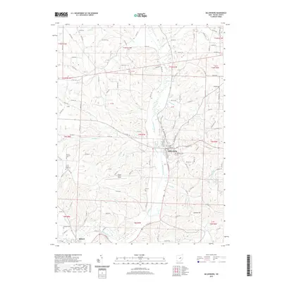
2019 Map of Millersburg
USGS Topo · Published 2019About this map
Millersburg serves as the focal point of this region, anchored by the Holmes County Courthouse and surrounded by a landscape of winding watercourses and family burial grounds. The settlement pattern follows the drainage of Killbuck Creek, which receives numerous tributaries including Sapps Run, Honey Run, and Hardy Run. This 2019 survey documents a dense concentration of cemeteries that speak to the long-standing community roots in Holmes County, such as Oak Grove Cem near the town center and the more outlying Monroe Lutheran Cem and Christy Chapel Cem. To the south, the village of Killbuck marks the confluence of Shrimplin Cr and the main creek, while prominent elevations like Sand Run Hill overlook the valley floor. The map also identifies the Holmes County Airport and a complex network of township roads that link the scattered agricultural homesteads of the area.
Find a feature on this map
123 named features on this map. Tap any name to fly to it.
Don’t see what you’re looking for? This feature index may not catch every label — zoom into the map to look around manually.
Map Details
Editions of this 2019 Millersburg Map
This is the sole edition of this map. No revisions or reprints were ever made.
Other maps of this area

1912 · Loudonville
USGS Topo · 1:62,500

1913 · Brinkhaven
USGS Topo · 1:62,500

1913 · Coshocton
USGS Topo · 1:62,500

1914 · Loudonville
USGS Topo · 1:62,500

1915 · Brinkhaven
USGS Topo · 1:62,500

1915 · Millersburg
USGS Topo · 1:62,500

1915 · Coshocton
USGS Topo · 1:62,500

1943 · Millersburg
USGS Topo · 1:62,500

1943 · Coshocton
USGS Topo · 1:62,500

1943 · Loudonville
USGS Topo · 1:62,500