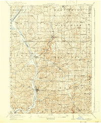
1915 Map of Millersburg
USGS Topo · Published 1943About this map
The Greenville Treaty Line cuts diagonally across this landscape, serving as a prominent historical boundary through the heart of the region. Centered on the town of Millersburg, the topography is defined by the winding course of Killbuck Creek and a dense network of smaller runs, including Sapps Run and Honey Run. The map illustrates a rural society organized around crossroads and school districts, with dozens of local educational institutions like Mt Nebo School, Bunker Hill School, and Oak Grove School dotting the countryside.
Find a feature on this map
106 named features on this map. Tap any name to fly to it.
Don’t see what you’re looking for? This feature index may not catch every label — zoom into the map to look around manually.
Map Details
Editions of this 1915 Millersburg Map
2 editions found

Other maps of this area

1901 · Massillon
USGS Topo · 1:62,500

1901 · Wooster
USGS Topo · 1:62,500

1903 · Massillon
USGS Topo · 1:62,500

1903 · Wooster
USGS Topo · 1:62,500

1906 · West Salem
USGS Topo · 1:62,500

1908 · West Salem
USGS Topo · 1:62,500

1911 · Newcomerstown
USGS Topo · 1:62,500

1912 · Loudonville
USGS Topo · 1:62,500

1913 · Newcomerstown
USGS Topo · 1:62,500

1913 · Brinkhaven
USGS Topo · 1:62,500