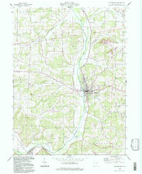
1994 Map of Millersburg
USGS Topo · Published 1998About this map
Millersburg serves as the central hub for this portion of Holmes County, situated along the winding course of Killbuck Creek. The landscape is defined by its dramatic relief and a dense network of watercourses, including Salt Creek and Paint Creek, which have carved out the surrounding valleys. A historical Treaty Line bisects the northern part of the map, marking an old frontier boundary that still influences the modern survey grid.
Find a feature on this map
39 named features on this map. Tap any name to fly to it.
Don’t see what you’re looking for? This feature index may not catch every label — zoom into the map to look around manually.
Map Details
Editions of this 1994 Millersburg Map
This is the sole edition of this map. No revisions or reprints were ever made.
Other maps of this area

1912 · Loudonville
USGS Topo · 1:62,500

1913 · Brinkhaven
USGS Topo · 1:62,500

1913 · Coshocton
USGS Topo · 1:62,500

1914 · Loudonville
USGS Topo · 1:62,500

1915 · Brinkhaven
USGS Topo · 1:62,500

1915 · Millersburg
USGS Topo · 1:62,500

1915 · Coshocton
USGS Topo · 1:62,500

1943 · Millersburg
USGS Topo · 1:62,500

1943 · Coshocton
USGS Topo · 1:62,500

1943 · Loudonville
USGS Topo · 1:62,500