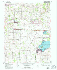
1961 Map of Millersport
USGS Topo · Published 1994About this map
Buckeye Lake State Park dominates the southeastern quadrant of this study, revealing a landscape defined by the remnants of the Ohio Canal and the recreational development along the shoreline at Millersport and East Millersport. The map captures a transitional period in Central Ohio, where traditional agricultural townships like Etna and Liberty meet modern infrastructure, including the National Trail Raceway and Buckeye Executive Airport. Genealogists will find a wealth of local history in the numerous burial grounds, such as Kirkersville Cem and the Refugee Cem, the latter situated near the historic Refugee Lands boundary. The northern reaches follow the South Fork Licking River through Kirkersville and Hebron, where the Hebron State Fish Hatchery sits near the junction of the abandoned canal and the Conrail line.
Find a feature on this map
45 named features on this map. Tap any name to fly to it.
Don’t see what you’re looking for? This feature index may not catch every label — zoom into the map to look around manually.
Map Details
Editions of this 1961 Millersport Map
3 editions found
Other maps of this area

1907 · Thurston
USGS Topo · 1:62,500

1908 · Granville
USGS Topo · 1:62,500

1909 · Newark
USGS Topo · 1:62,500

1909 · Thornville
USGS Topo · 1:62,500

1909 · Thurston
USGS Topo · 1:62,500

1910 · Granville
USGS Topo · 1:62,500

1947 · Columbus
USGS Topo · 1:250,000

1950 · Marion
USGS Topo · 1:250,000

1958 · Carroll
USGS Topo · 1:24,000
1958 · Pataskala
USGS Topo · 1:24,000