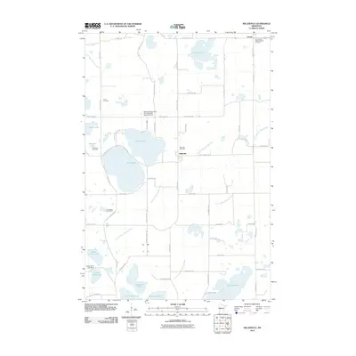
2010 Map of Millerville
USGS Topo · Published 2010About this map
Millerville and Urbank anchor this portion of Douglas County, characterized by a complex network of glacial lakes and managed waterways. Central to the area are the connected basins of Lake Aaron and Lake Moses, while larger bodies like Chippewa Lake and Lake George dominate the surrounding terrain. The landscape is also defined by mid-century water management and recreation, featuring several infrastructure points such as the Upper Hunt Lake Dam and the Anderson Lake Dam. Local history is preserved through sites like the Sacred Heart Catholic Church and its accompanying Sacred Heart Catholic Church Cemetery, along with Trinity Cemetery to the west. The presence of County Ditch Number Sixty and County Ditch Number Fourteen highlights the extensive drainage systems required for the region's agricultural development, while the Pine Ridge Golf Course reflects later land-use shifts toward leisure.
Find a feature on this map
65 named features on this map. Tap any name to fly to it.
Don’t see what you’re looking for? This feature index may not catch every label — zoom into the map to look around manually.
Map Details
Editions of this 2010 Millerville Map
This is the sole edition of this map. No revisions or reprints were ever made.
Other maps of this area

1953 · Brainerd
USGS Topo · 1:250,000

1953 · Saint Cloud
USGS Topo · 1:250,000

1957 · Brainerd
USGS Topo · 1:250,000

1957 · Saint Cloud
USGS Topo · 1:250,000

1958 · Saint Cloud
USGS Topo · 1:250,000

1958 · Brainerd
USGS Topo · 1:250,000

1965 · Brainerd
USGS Topo · 1:250,000

1966 · Brandon
USGS Topo · 1:24,000

1966 · Alexandria West
USGS Topo · 1:24,000

1966 · Quam Lake
USGS Topo · 1:24,000