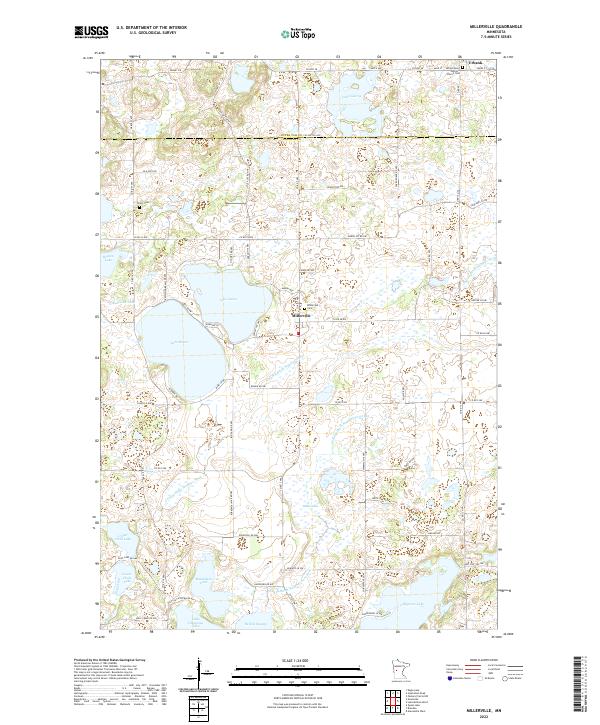
2022 Map of Millerville
USGS Topo · Published 2022About this map
Millerville serves as the central hub of this lake-studded landscape on the border of Otter Tail and Douglas Counties. The settlement's local history is anchored by the Millerville Cem and the nearby Trinity Cem, while further north, the community of Urbank is centered on the Sacred Heart Catholic Church. The terrain is defined by a dense network of glacial basins and managed waterways, including Lake Aaron, Lake Moses, and Lake George.
Find a feature on this map
79 named features on this map. Tap any name to fly to it.
Don’t see what you’re looking for? This feature index may not catch every label — zoom into the map to look around manually.
Map Details
Editions of this 2022 Millerville Map
This is the sole edition of this map. No revisions or reprints were ever made.
Other maps of this area

1953 · Brainerd
USGS Topo · 1:250,000

1953 · Saint Cloud
USGS Topo · 1:250,000

1957 · Brainerd
USGS Topo · 1:250,000

1957 · Saint Cloud
USGS Topo · 1:250,000

1958 · Saint Cloud
USGS Topo · 1:250,000

1958 · Brainerd
USGS Topo · 1:250,000

1965 · Brainerd
USGS Topo · 1:250,000

1966 · Brandon
USGS Topo · 1:24,000

1966 · Alexandria West
USGS Topo · 1:24,000

1966 · Quam Lake
USGS Topo · 1:24,000