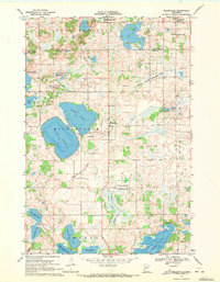
1969 Map of Millerville
USGS Topo · Published 1971About this map
The glacial landscape of west-central Minnesota is defined here by the prominent Leaf Mountain ridge and a dense network of lakes and wetlands. The settlement of Millerville serves as a central hub, while the village of Urbank is positioned to the north near the Otter Tail and Douglas County line. This 1969 field-checked survey highlights the region's transition from agricultural plots to extensive conservation areas, specifically through the numerous tracts designated as National Wildlife Management Areas.
Find a feature on this map
24 named features on this map. Tap any name to fly to it.
Don’t see what you’re looking for? This feature index may not catch every label — zoom into the map to look around manually.
Map Details
Editions of this 1969 Millerville Map
This is the sole edition of this map. No revisions or reprints were ever made.
Other maps of this area

1953 · Brainerd
USGS Topo · 1:250,000

1953 · Saint Cloud
USGS Topo · 1:250,000

1957 · Brainerd
USGS Topo · 1:250,000

1957 · Saint Cloud
USGS Topo · 1:250,000

1958 · Saint Cloud
USGS Topo · 1:250,000

1958 · Brainerd
USGS Topo · 1:250,000

1965 · Brainerd
USGS Topo · 1:250,000

1966 · Brandon
USGS Topo · 1:24,000

1966 · Alexandria West
USGS Topo · 1:24,000

1966 · Quam Lake
USGS Topo · 1:24,000