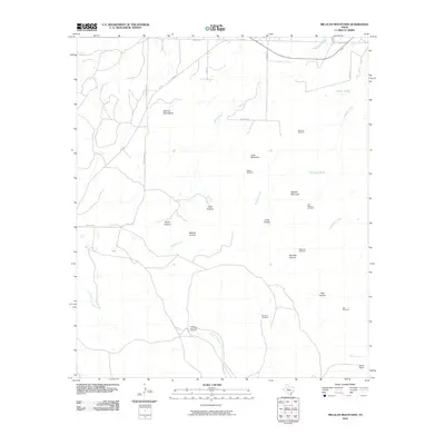
2010 Map of Millican Mountains
USGS Topo · Published 2010About this map
Millican Mountains and Lone Mountain anchor this West Texas landscape, where the primary infrastructure consists of ranch roads and scattered water sources. The map records a series of named windmills, such as Schooler Windmill and the Head of the Creek Windmill, which reflect the area's ongoing reliance on groundwater to support livestock in a semi-arid environment. These landmarks often bear family or ranch names, offering specific geographic data for local history and genealogy research.
Find a feature on this map
33 named features on this map. Tap any name to fly to it.
Don’t see what you’re looking for? This feature index may not catch every label — zoom into the map to look around manually.
Map Details
Editions of this 2010 Millican Mountains Map
This is the sole edition of this map. No revisions or reprints were ever made.
Other maps of this area

1891 · Hayrick
USGS Topo · 1:125,000

1894 · Hayrick
USGS Topo · 1:125,000

1954 · San Angelo
USGS Topo · 1:250,000

1957 · Carlsbad
USGS Topo · 1:62,500

1957 · Harriet
USGS Topo · 1:62,500

1958 · San Angelo
USGS Topo · 1:250,000

1962 · Edith
USGS Topo · 1:24,000
1962 · Cement Mountain
USGS Topo · 1:24,000
1962 · Millican Mountains
USGS Topo · 1:24,000

1962 · Green Mountain
USGS Topo · 1:24,000