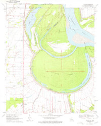
1970 Map of Millikin
USGS Topo · Published 1978About this map
Pittman Island and Sarah Island dominate the center of this 1970s survey, defined by the sweeping curves of the Mississippi River and its man-made cutoffs. The landscape is a complex network of active and former river channels, featuring the Sarah Cutoff and Bunchs Cutoff which have isolated large tracts of land between East Carroll Parish, Louisiana, and Issaquena County, Mississippi. Along the western levee, the Missouri Pacific railroad corridor links small agricultural settlements like Millikin, Gassoway, and Shelburn. This map provides a detailed look at the rural social geography of the era, recording several community focal points including Mt Pleasant Ch, Rose Hill Ch, and Jerusalem Ch. The density of burial sites such as Panola Cem and Old St Paul Cem reflects a deeply rooted riverfront population navigating the shifting hydrology of the delta.
Find a feature on this map
35 named features on this map. Tap any name to fly to it.
Don’t see what you’re looking for? This feature index may not catch every label — zoom into the map to look around manually.
Map Details
Editions of this 1970 Millikin Map
2 editions found
Other maps of this area

1909 · Baxter Bayou
USGS Topo · 1:24,000

1909 · Lake Providence
USGS Topo · 1:24,000

1909 · Wilsons Point
USGS Topo · 1:24,000

1909 · Millikin
USGS Topo · 1:24,000

1909 · Ashton Bridge
USGS Topo · 1:24,000

1911 · Lake Providence
USGS Topo · 1:31,680

1911 · Baxter Bayou
USGS Topo · 1:24,000

1912 · Ashton Bridge
USGS Topo · 1:31,680

1913 · Wilson Point
USGS Topo · 1:31,680

1914 · Baxter Bayou
USGS Topo · 1:31,680