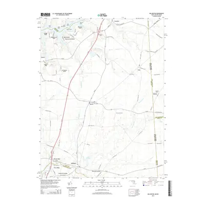
2014 Map of Millington
USGS Topo · Published 2014About this map
Millington and Galena anchor the landscape of the Eastern Shore Delmarva Peninsula in this 2014 survey. The territory is defined by complex river systems and border lines, where the Chester River and Sassafras River shape the boundaries between Maryland and Delaware. The map documents a predominantly rural infrastructure characterized by small residential enclaves such as Rivers Edge, Piney Ridge, and Shorewood Estates. Aviation and agricultural history intersect at the Schlosser Airport and Massey Aerodrome, which serve as prominent landmarks amidst the creek-fed lowlands. This detailed record highlights the distribution of community hubs like Massey and Golts, along with significant local sites like Saint Clements Cem. The presence of established water bodies, including Mill Pond and Little Mill Pond, illustrates the persistent role of local hydraulics in the region's geography and settlement patterns.
Find a feature on this map
103 named features on this map. Tap any name to fly to it.
Don’t see what you’re looking for? This feature index may not catch every label — zoom into the map to look around manually.
Map Details
Editions of this 2014 Millington Map
This is the sole edition of this map. No revisions or reprints were ever made.
Other maps of this area

1899 · Dover
USGS Topo · 1:125,000

1900 · Cecilton
USGS Topo · 1:62,500

1905 · Barclay
USGS Topo · 1:62,500

1906 · Dover
USGS Topo · 1:125,000

1920 · Dover
USGS Topo · 1:125,000

1926 · Wyoming
USGS Topo · 1:48,000

1930 · Wyoming
USGS Topo · 1:62,500

1931 · Wyoming
USGS Topo · 1:62,500

1931 · Smyrna
USGS Topo · 1:62,500
1944 · Earleville
USGS Topo · 1:31,680