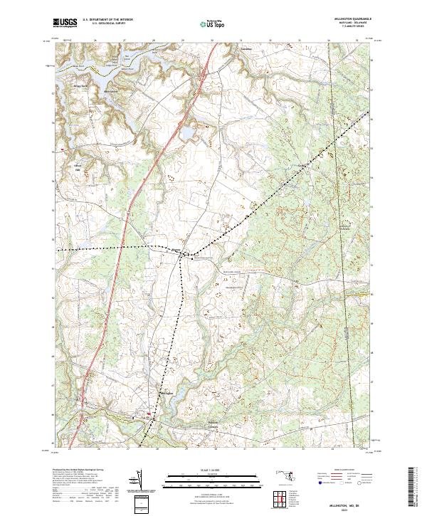
2023 Map of Millington
USGS Topo · Published 2023About this map
The Sassafras River forms a jagged northern boundary for this section of the Delmarva Peninsula, where the landscape is defined by the branching creeks and headwaters that feed both the Sassafras and the Chester River. Small agrarian settlements like Massey and Golts sit at critical road junctions, reflecting the enduring rural character of Kent County. The presence of the Massey Aerodrome and several historic burial grounds, including Saint Clements Episcopal Cem and Wesley Cem, provides a detailed record of local transit and community heritage. The town of Millington serves as a hub near the southern edge, situated where the Cypress Branch meets the Andover Branch. This survey illustrates the intricate network of local roads such as Galena Sassafras Rd and Black Bottom Rd that connect these dispersed communities across the Maryland and Delaware state line.
Find a feature on this map
90 named features on this map. Tap any name to fly to it.
Don’t see what you’re looking for? This feature index may not catch every label — zoom into the map to look around manually.
Map Details
Editions of this 2023 Millington Map
This is the sole edition of this map. No revisions or reprints were ever made.
Other maps of this area

1899 · Dover
USGS Topo · 1:125,000

1900 · Cecilton
USGS Topo · 1:62,500

1905 · Barclay
USGS Topo · 1:62,500

1906 · Dover
USGS Topo · 1:125,000

1920 · Dover
USGS Topo · 1:125,000

1926 · Wyoming
USGS Topo · 1:48,000

1930 · Wyoming
USGS Topo · 1:62,500

1931 · Wyoming
USGS Topo · 1:62,500

1931 · Smyrna
USGS Topo · 1:62,500
1944 · Earleville
USGS Topo · 1:31,680