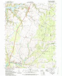
1993 Map of Millington
USGS Topo · Published 1993About this map
The Sassafras River forms the northern boundary of this 1993 edition, where tidal inlets and creek landings like Budd Landing and Fox Hole Landing meet the low-lying agricultural plains of Kent County. The landscape is defined by its transition from the riverfront communities of Gregg Neck and Shorewood to the deep forest of the Millington State Wildlife Management Area.
Find a feature on this map
67 named features on this map. Tap any name to fly to it.
Don’t see what you’re looking for? This feature index may not catch every label — zoom into the map to look around manually.
Map Details
Editions of this 1993 Millington Map
This is the sole edition of this map. No revisions or reprints were ever made.
Other maps of this area

1899 · Dover
USGS Topo · 1:125,000

1900 · Cecilton
USGS Topo · 1:62,500

1905 · Barclay
USGS Topo · 1:62,500

1906 · Dover
USGS Topo · 1:125,000

1920 · Dover
USGS Topo · 1:125,000

1926 · Wyoming
USGS Topo · 1:48,000

1930 · Wyoming
USGS Topo · 1:62,500

1931 · Wyoming
USGS Topo · 1:62,500

1931 · Smyrna
USGS Topo · 1:62,500
1944 · Earleville
USGS Topo · 1:31,680