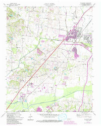
1971 Map of Millington
USGS Topo · Published 1994About this map
Millington and its surrounding Shelby County landscape appear in this detailed survey, highlighting a period of significant military and civic infrastructure. The sprawling US Naval Air Station dominates the northeastern quadrant, while the Illinois Central Gulf corridor serves as the primary spine for industrial and residential growth. This alignment links the northern settlements of West Union and Sloanville with the southern reaches near the Loosahatchie River and Woodstock.
Find a feature on this map
61 named features on this map. Tap any name to fly to it.
Don’t see what you’re looking for? This feature index may not catch every label — zoom into the map to look around manually.
Map Details
Editions of this 1971 Millington Map
3 editions found
Other maps of this area

1916 · Memphis
USGS Topo · 1:62,500

1925 · Memphis
USGS Topo · 1:48,000

1927 · Memphis
USGS Topo · 1:62,500

1931 · Jericho
USGS Topo · 1:62,500

1939 · Jericho
USGS Topo · 1:62,500

1939 · Memphis
USGS Topo · 1:62,500

1942 · Millington
USGS Topo · 1:62,500

1952 · Jericho
USGS Topo · 1:62,500

1953 · Memphis
USGS Topo · 1:250,000

1955 · Memphis
USGS Topo · 1:62,500