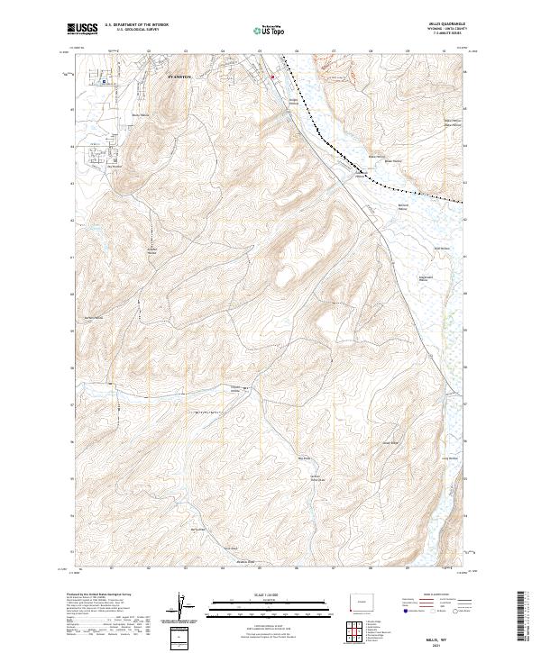
2021 Map of Millis
USGS Topo · Published 2021About this map
Evanston serves as the focal point for this corner of Uinta County, showing the southern expansion of the city into a landscape defined by complex drainage systems and traditional ranching terrain. The Bear River winds through the eastern portion of the sheet, supported by man-made infrastructure like the City Ditch and the East Reservoir. The naming of the local topography reflects a long history of cattle and sheep ranching, with dozens of named draws and hollows like Stagecoach Hollow, Glasscock Hollow, and Knight Hollow punctuating the high ridges.
Find a feature on this map
56 named features on this map. Tap any name to fly to it.
Don’t see what you’re looking for? This feature index may not catch every label — zoom into the map to look around manually.
Map Details
Editions of this 2021 Millis Map
This is the sole edition of this map. No revisions or reprints were ever made.
Other maps of this area

1954 · Ogden
USGS Topo · 1:250,000

1958 · Ogden
USGS Topo · 1:250,000

1960 · Ogden
USGS Topo · 1:250,000

1965 · Evanston
USGS Topo · 1:24,000

1965 · Myers Reservoir
USGS Topo · 1:24,000

1965 · Sulphur Creek Reservoir
USGS Topo · 1:24,000

1965 · Guild Hollow
USGS Topo · 1:24,000
1965 · Pine Knoll
USGS Topo · 1:24,000

1965 · Millis
USGS Topo · 1:24,000

1968 · Wahsatch
USGS Topo · 1:24,000