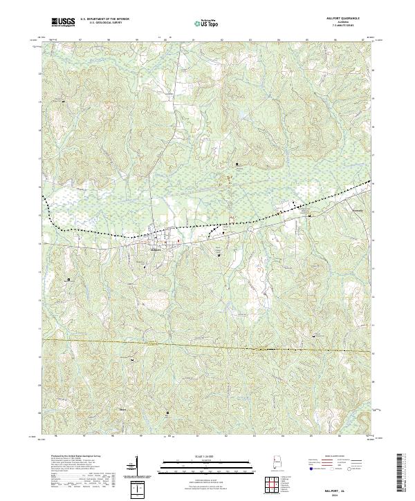
2024 Map of Millport
USGS Topo · Published 2024About this map
Millport serves as a primary center of activity in this Lamar County landscape, situated where the Luxapallila Valley RR cuts through the river valley. The topography is defined by the winding course of Luxapallila Creek and its many tributaries, including Propst Creek and Driver Creek, which drain the surrounding highlands. This area exhibits a deep-rooted pattern of small communities and rural family church sites, often marked by their accompanying cemeteries such as Oddfellows Cem and Holly Grove Cem.
Find a feature on this map
86 named features on this map. Tap any name to fly to it.
Don’t see what you’re looking for? This feature index may not catch every label — zoom into the map to look around manually.
Map Details
Editions of this 2024 Millport Map
This is the sole edition of this map. No revisions or reprints were ever made.
Other maps of this area

1953 · Birmingham
USGS Topo · 1:250,000

1953 · West Point
USGS Topo · 1:250,000

1956 · Birmingham
USGS Topo · 1:250,000

1957 · Birmingham
USGS Topo · 1:250,000

1958 · West Point
USGS Topo · 1:250,000

1963 · West Point
USGS Topo · 1:250,000

1966 · Ethelsville
USGS Topo · 1:24,000

1967 · Hightogy
USGS Topo · 1:24,000

1967 · Kennedy
USGS Topo · 1:24,000

1967 · Millport
USGS Topo · 1:24,000