
1967 Map of Millport NW
USGS Topo · Published 1968About this map
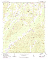
The town of Vernon anchors the upper corner of this Lamar County survey, where the landscape transitions into a network of creek drainages and community landmarks. The topography is defined by the winding paths of Wilson Creek, Cut Bank Creek, and Yellow Creek, which carve through the wooded terrain. Education and faith were central to the area's rural social structure, evidenced by the presence of institutions like the Lamar County Training Sch and Todd High Sch. Community life is further traced through a high concentration of country churches and cemeteries, including Poplar Springs Ch, Murray Chapel, and Old Asbury Cem. Small-scale industry is marked by several Gravel Pits scattered near the watercourses, while Rogers Lake and McGee Lake provide significant local water features. The state line with Mississippi runs along the western edge, marking the boundary for these Alabama hill country settlements.
Find a feature on this map
34 named features on this map. Tap any name to fly to it.
Don’t see what you’re looking for? This feature index may not catch every label — zoom into the map to look around manually.
Map Details
Editions of this 1967 Millport NW Map
3 editions found
Other maps of this area

1953 · West Point
USGS Topo · 1:250,000

1958 · West Point
USGS Topo · 1:250,000

1960 · Caledonia
USGS Topo · 1:62,500

1963 · West Point
USGS Topo · 1:250,000

1966 · Amory SE
USGS Topo · 1:24,000

1967 · Hightogy
USGS Topo · 1:24,000

1967 · Millport
USGS Topo · 1:24,000

1967 · Sulligent SW
USGS Topo · 1:24,000

1967 · Fernbank
USGS Topo · 1:24,000
1967 · Vernon
USGS Topo · 1:24,000