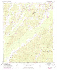
1967 Map of Millport NW
USGS Topo · Published 1982About this map
Vernon serves as a primary local center in this 1967 survey of Lamar County, Alabama. The landscape is defined by the winding paths of Yellow Creek, Wilson Creek, and Watson Creek, which cut through the terrain to create a network of drainage systems such as the Stillman Ditch. This era shows a community deeply rooted in its local institutions, evidenced by the distribution of numerous country churches and schools like the Lamar County Training Sch and Todd High Sch.
Find a feature on this map
32 named features on this map. Tap any name to fly to it.
Don’t see what you’re looking for? This feature index may not catch every label — zoom into the map to look around manually.
Map Details
Editions of this 1967 Millport NW Map
3 editions found
Other maps of this area

1953 · West Point
USGS Topo · 1:250,000

1958 · West Point
USGS Topo · 1:250,000

1960 · Caledonia
USGS Topo · 1:62,500

1963 · West Point
USGS Topo · 1:250,000

1966 · Amory SE
USGS Topo · 1:24,000

1967 · Hightogy
USGS Topo · 1:24,000

1967 · Millport
USGS Topo · 1:24,000

1967 · Sulligent SW
USGS Topo · 1:24,000

1967 · Millport NW
USGS Topo · 1:24,000

1967 · Fernbank
USGS Topo · 1:24,000