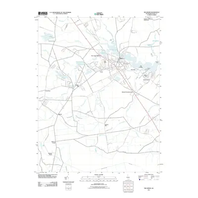
2011 Map of Millsboro
USGS Topo · Published 2011About this map
Millsboro serves as the focal point for this Sussex County landscape, situated where the Indian River meets the freshwater headwaters of Millsboro Pond. The area is characterized by an extensive network of drainage ditches and branches, including Whartons Ditch, Sheep Pen Ditch, and Long Drain Ditch, illustrating the managed hydrology of Delaware’s coastal plain. Residential developments like Pine Lodge Addition and Oak Drive surround the town center, while peripheral settlements such as Mission, Phillips Hill, and Shaft Ox Corner reflect a more dispersed rural pattern.
Find a feature on this map
135 named features on this map. Tap any name to fly to it.
Don’t see what you’re looking for? This feature index may not catch every label — zoom into the map to look around manually.
Map Details
Editions of this 2011 Millsboro Map
This is the sole edition of this map. No revisions or reprints were ever made.
Other maps of this area

1901 · Ocean City
USGS Topo · 1:62,500

1902 · Pittsville
USGS Topo · 1:62,500

1917 · Millsboro
USGS Topo · 1:62,500

1918 · Rehoboth
USGS Topo · 1:62,500

1938 · Millsboro
USGS Topo · 1:62,500

1938 · Rehoboth
USGS Topo · 1:62,500

1942 · Ocean City
USGS Topo · 1:62,500

1942 · Whaleysville
USGS Topo · 1:24,000

1942 · Pittsville
USGS Topo · 1:24,000

1943 · Selbyville
USGS Topo · 1:31,680