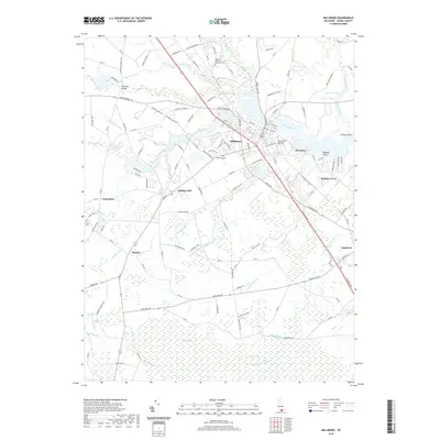
2019 Map of Millsboro
USGS Topo · Published 2019About this map
Millsboro and Dagsboro anchor this 2019 survey of southeastern Sussex County, where the Indian River and its numerous drainage systems define the local geography. The landscape is heavily characterized by sophisticated water management, evidenced by features such as Sheep Pen Ditch, Houston-Thorogood Ditch, and Cypress-Earth Ditch. These man-made channels crisscross the low-lying terrain, particularly around the fringes of the Cypress Swamp and Burnt Swamp, facilitating drainage for agriculture and development in this coastal plain region.
Find a feature on this map
136 named features on this map. Tap any name to fly to it.
Don’t see what you’re looking for? This feature index may not catch every label — zoom into the map to look around manually.
Map Details
Editions of this 2019 Millsboro Map
This is the sole edition of this map. No revisions or reprints were ever made.
Other maps of this area

1901 · Ocean City
USGS Topo · 1:62,500

1902 · Pittsville
USGS Topo · 1:62,500

1917 · Millsboro
USGS Topo · 1:62,500

1918 · Rehoboth
USGS Topo · 1:62,500

1938 · Millsboro
USGS Topo · 1:62,500

1938 · Rehoboth
USGS Topo · 1:62,500

1942 · Ocean City
USGS Topo · 1:62,500

1942 · Whaleysville
USGS Topo · 1:24,000

1942 · Pittsville
USGS Topo · 1:24,000

1943 · Selbyville
USGS Topo · 1:31,680