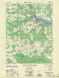
1955 Map of Millsboro
USGS Topo · Published 1955About this map
Millsboro and Dagsboro anchor this mid-century portrait of Sussex County, where the Pennsylvania railroad and the Dupont Highway slice through a landscape defined by intricate drainage networks. The headwaters of the Indian River are fed by numerous family-named and functional waterways like Betts Pond and Waples Pond, while the southern reaches transition into the dense Burnt Swamp. This environment dictated a settlement pattern of small, dispersed communities such as Phillips Hill, Mission, and Shaft Ox Corner.
Find a feature on this map
49 named features on this map. Tap any name to fly to it.
Don’t see what you’re looking for? This feature index may not catch every label — zoom into the map to look around manually.
Map Details
Editions of this 1955 Millsboro Map
This is the sole edition of this map. No revisions or reprints were ever made.
Other maps of this area

1901 · Ocean City
USGS Topo · 1:62,500

1902 · Pittsville
USGS Topo · 1:62,500

1917 · Millsboro
USGS Topo · 1:62,500

1918 · Rehoboth
USGS Topo · 1:62,500

1938 · Millsboro
USGS Topo · 1:62,500

1938 · Rehoboth
USGS Topo · 1:62,500

1942 · Ocean City
USGS Topo · 1:62,500

1942 · Whaleysville
USGS Topo · 1:24,000

1942 · Pittsville
USGS Topo · 1:24,000

1943 · Selbyville
USGS Topo · 1:31,680