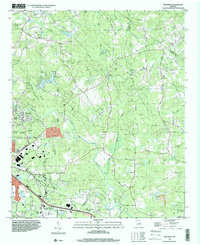
1993 Map of Milstead
USGS Topo · Published 2000About this map
The Yellow River winds through this landscape, defining the topography south of Zingara and east of Conyers. In the early 1990s, the area retained a mix of its rural character and growing suburban infrastructure, anchored by several long-standing community centers. The northern portion is marked by historical landmarks such as the Hightower Indian Trail Monument and a network of country churches including Philadelphia Ch and Double Springs Ch.
Find a feature on this map
61 named features on this map. Tap any name to fly to it.
Don’t see what you’re looking for? This feature index may not catch every label — zoom into the map to look around manually.
Map Details
Editions of this 1993 Milstead Map
This is the sole edition of this map. No revisions or reprints were ever made.
Other maps of this area

1888 · Atlanta
USGS Topo · 1:125,000

1890 · Atlanta
USGS Topo · 1:125,000

1892 · Atlanta
USGS Topo · 1:125,000

1895 · Atlanta
USGS Topo · 1:125,000

1896 · Monroe
USGS Topo · 1:125,000

1953 · Atlanta
USGS Topo · 1:250,000

1953 · Athens
USGS Topo · 1:250,000

1956 · Snellville
USGS Topo · 1:24,000

1956 · Conyers
USGS Topo · 1:24,000

1957 · Atlanta
USGS Topo · 1:250,000