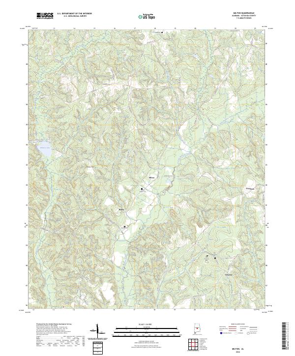
2024 Map of Milton
USGS Topo · Published 2024About this map
Little Mulberry Creek and its many tributaries, including Motley Branch and Ivy Creek, carve a detailed drainage pattern across this Autauga County landscape. Small rural communities and homesteads are scattered throughout the region, centered around the settlement of Milton and the nearby Bonita. The area's genealogical history is well-preserved through several distinct burial sites, including the Milton Baptist Cem, Bishop Cem, and the dual locations of Old Harmony Cem and New Harmony Cem.
Find a feature on this map
54 named features on this map. Tap any name to fly to it.
Don’t see what you’re looking for? This feature index may not catch every label — zoom into the map to look around manually.
Map Details
Editions of this 2024 Milton Map
This is the sole edition of this map. No revisions or reprints were ever made.
Other maps of this area

1891 · Clanton
USGS Topo · 1:125,000

1953 · Montgomery
USGS Topo · 1:250,000

1956 · Montgomery
USGS Topo · 1:250,000

1957 · Montgomery
USGS Topo · 1:250,000

1957 · Autaugaville
USGS Topo · 1:62,500

1957 · Benton
USGS Topo · 1:62,500

1959 · Plantersville
USGS Topo · 1:62,500

1959 · Billingsley
USGS Topo · 1:62,500

1975 · Plantersville SE
USGS Topo · 1:24,000
1975 · Benton NE
USGS Topo · 1:24,000