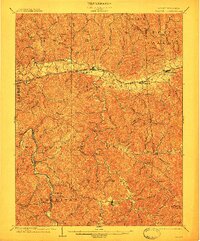
1902 Map of Milton
USGS Topo · Published 1911About this map
Mud River winds through the heart of the Teays Valley, dictating the settlement patterns of this West Virginia landscape at the dawn of the twentieth century. The Chesapeake and Ohio railroad corridor anchors the northern reach, connecting the towns of Milton, Culloden, and Hurricane. This infrastructure contrasts with the deeply dissected plateaus to the south, where life centered on river fords and small creek-side outposts.
Find a feature on this map
85 named features on this map. Tap any name to fly to it.
Don’t see what you’re looking for? This feature index may not catch every label — zoom into the map to look around manually.
Map Details
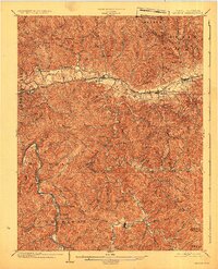
Editions of this 1902 Milton Map
3 editions found
Other maps of this area

1892 · Huntington
USGS Topo · 1:125,000

1898 · Huntington
USGS Topo · 1:125,000

1899 · Charleston
USGS Topo · 1:125,000

1901 · Guyandot
USGS Topo · 1:62,500

1902 · Guyandot
USGS Topo · 1:62,500

1902 · Milton
USGS Topo · 1:62,500

1902 · Midkiff
USGS Topo · 1:62,500

1906 · Athalia
USGS Topo · 1:62,500

1906 · Glenwood
USGS Topo · 1:62,500

1906 · Winfield
USGS Topo · 1:62,500