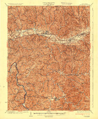
1935 Map of Milton
USGS Topo · Published 1935About this map
The Mud River and Guyandot River valleys anchor this mid-1930s landscape, illustrating a transition from traditional rural life to a connected regional economy. The Midland Highway and the Chesapeake and Ohio Railway serve as primary east-west corridors through Milton and Culloden, facilitating movement across the winding ridges of Cabell and Lincoln Counties.
Find a feature on this map
138 named features on this map. Tap any name to fly to it.
Don’t see what you’re looking for? This feature index may not catch every label — zoom into the map to look around manually.
Map Details
Editions of this 1935 Milton Map
3 editions found
Other maps of this area

1892 · Huntington
USGS Topo · 1:125,000

1898 · Huntington
USGS Topo · 1:125,000

1899 · Charleston
USGS Topo · 1:125,000

1901 · Guyandot
USGS Topo · 1:62,500

1902 · Guyandot
USGS Topo · 1:62,500

1902 · Milton
USGS Topo · 1:62,500

1902 · Midkiff
USGS Topo · 1:62,500

1906 · Athalia
USGS Topo · 1:62,500

1906 · Glenwood
USGS Topo · 1:62,500

1906 · Winfield
USGS Topo · 1:62,500