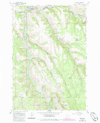
1964 Map of Minam
USGS Topo · Published 1985About this map
The confluence of the Wallowa River and Minam River forms the geographic heart of this mid-century survey, centered on the settlement of Minam. The town serves as a critical junction where the Union Pacific railroad line follows the riverbank, supported by a nearby Substation. This area is characterized by the transition from river valley recreation at the Minam State Rec Area to the high-elevation timberlands of the Wallowa Nat Forest. Higher up the slopes, a network of tracks like the Cougar (Pack) Trail and various Jeep Trails provide access to the ridges. Isolated water sources, including Chestnut Spring and Alder Spring, are scattered across the drainage basins of Big Deer Creek and Squaw Creek, marking vital points for forest management and local travel in this corner of Northeast Oregon.
Find a feature on this map
28 named features on this map. Tap any name to fly to it.
Don’t see what you’re looking for? This feature index may not catch every label — zoom into the map to look around manually.
Map Details
Editions of this 1964 Minam Map
2 editions found
Other maps of this area

1906 · Telocaset
USGS Topo · 1:125,000

1955 · Grangeville
USGS Topo · 1:250,000

1959 · Grangeville
USGS Topo · 1:250,000

1964 · Howard Butte
USGS Topo · 1:24,000

1964 · Akers Butte
USGS Topo · 1:24,000

1964 · Cricket Flat
USGS Topo · 1:24,000

1964 · Wallowa
USGS Topo · 1:24,000

1964 · Minam
USGS Topo · 1:24,000

1964 · Rondowa
USGS Topo · 1:24,000

1965 · Fox Point
USGS Topo · 1:24,000