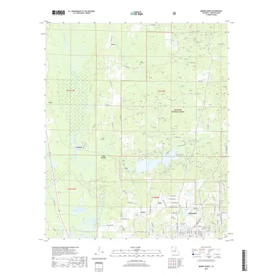
2018 Map of Minden North
USGS Topo · Published 2018About this map
Minden anchoring the southern edge, this area of Webster Parish exhibits a landscape defined by both timbered conservation and rural expansion. Much of the northeastern terrain is occupied by the Kisatchie National Forest, while the western boundary follows the winding course of Bayou Dorcheat. This modern survey details the transition from the city’s residential streets, such as Lewisville Rd and Park Hwy, to the outlying settlements of Gilark, Long Springs, and Grove. Local history is preserved in several scattered burial grounds including Garden of Memory Cem and the Shady Grove Cem. The presence of the Minden Airport and the sprawling Caney Lakes recreational areas illustrates the diverse land use in the region, where infrastructure meets the protected natural environment of North Louisiana.
Find a feature on this map
90 named features on this map. Tap any name to fly to it.
Don’t see what you’re looking for? This feature index may not catch every label — zoom into the map to look around manually.
Map Details
Editions of this 2018 Minden North Map
This is the sole edition of this map. No revisions or reprints were ever made.
Other maps of this area

1922 · Sarepta
USGS Topo · 1:62,500

1924 · Sarepta
USGS Topo · 1:62,500

1947 · Minden
USGS Topo · 1:62,500

1949 · Minden
USGS Topo · 1:62,500

1949 · Gibsland
USGS Topo · 1:62,500

1950 · Gibsland
USGS Topo · 1:62,500

1952 · Homer
USGS Topo · 1:62,500

1955 · Shreveport
USGS Topo · 1:250,000

1956 · Shreveport
USGS Topo · 1:250,000

1956 · Sarepta
USGS Topo · 1:62,500