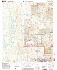
2003 Map of Minden North
USGS Topo · Published 2005About this map
Bayou Dorcheat dominates the western landscape of this Webster Parish survey, winding through a terrain defined by the northern reaches of the Kisatchie National Forest. The map documents the recreational and industrial balance of the early 21st century, featuring the Caney Creek Recreation Area and Caney Creek Lakes alongside numerous gravel pits and natural gas pipelines. The southern edge captures the expansion of Minden, including the Minden-Webster Airport, the Fairground, and civic spaces like Victory Park. Genealogists will find a dense network of rural landmarks, from the Whispering Pines Ch and New Hope Ch to family-named sites such as Walker Cem and Allen Cem. The presence of the Northwest La Voc-Tech Sch and Harper Sch near the city center illustrates the regional importance of this area as an educational and transport hub.
Find a feature on this map
46 named features on this map. Tap any name to fly to it.
Don’t see what you’re looking for? This feature index may not catch every label — zoom into the map to look around manually.
Map Details
Editions of this 2003 Minden North Map
This is the sole edition of this map. No revisions or reprints were ever made.
Other maps of this area

1922 · Sarepta
USGS Topo · 1:62,500

1924 · Sarepta
USGS Topo · 1:62,500

1947 · Minden
USGS Topo · 1:62,500

1949 · Minden
USGS Topo · 1:62,500

1949 · Gibsland
USGS Topo · 1:62,500

1950 · Gibsland
USGS Topo · 1:62,500

1952 · Homer
USGS Topo · 1:62,500

1955 · Shreveport
USGS Topo · 1:250,000

1956 · Shreveport
USGS Topo · 1:250,000

1956 · Sarepta
USGS Topo · 1:62,500