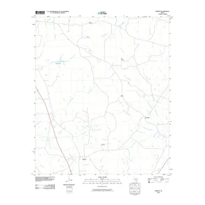
2010 Map of Minden
USGS Topo · Published 2010About this map
Minden and Brachfield anchor this rural landscape in East Texas, where the terrain is defined by a dense network of tributaries feeding into the larger drainage systems of Rusk County. Significant for local genealogists, the map identifies several distinct family and community burial sites, including the Old Minden Cemetery south of its namesake town and the Little Family Cemetery located near Dry Branch. The hydraulic landscape is influenced by Lake Mann, created by the Lake Mann Dam along Walker Branch, while Minden Creek and Jarrell Creek carve paths through the southern and central sections of the quadrangle.
Find a feature on this map
26 named features on this map. Tap any name to fly to it.
Don’t see what you’re looking for? This feature index may not catch every label — zoom into the map to look around manually.
Map Details
Editions of this 2010 Minden Map
This is the sole edition of this map. No revisions or reprints were ever made.
Other maps of this area

1935 · Henderson
USGS Topo · 1:48,000

1939 · Henderson
USGS Topo · 1:62,500

1943 · Cushing
USGS Topo · 1:62,500

1945 · Cushing
USGS Topo · 1:62,500

1953 · Palestine
USGS Topo · 1:250,000

1956 · Tyler
USGS Topo · 1:250,000

1957 · Palestine
USGS Topo · 1:250,000

1960 · Minden
USGS Topo · 1:62,500

1960 · Mount Enterprise
USGS Topo · 1:62,500

1973 · Henderson
USGS Topo · 1:24,000