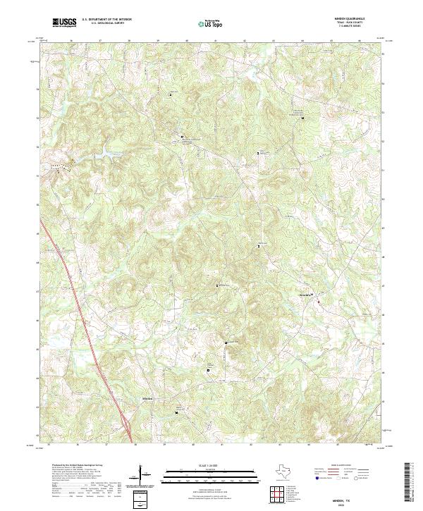
2022 Map of Minden
USGS Topo · Published 2022About this map
Minden and Brachfield anchor this rural landscape in southeastern Rusk County, where the terrain is defined by a dense network of creek drainages including Murvaul Cr and Irons Bayou. This area preserves a high concentration of small, family-named burial grounds and church yards that serve as vital records for genealogists. Clusters of historic sites like the Old Minden Cem and the Pine Grove Cumberland Presbyterian Cem suggest long-standing community centers tied to the land. The presence of Railroad St in the southwest corner indicates the enduring influence of former rail corridors on local geography. Numerous small tributaries such as Welch Springs Br and Walker Branch carve through the hills, illustrating the hydrological pattern that dictated early settlement and agricultural placement in this part of Texas.
Find a feature on this map
76 named features on this map. Tap any name to fly to it.
Don’t see what you’re looking for? This feature index may not catch every label — zoom into the map to look around manually.
Map Details
Editions of this 2022 Minden Map
This is the sole edition of this map. No revisions or reprints were ever made.
Other maps of this area

1935 · Henderson
USGS Topo · 1:48,000

1939 · Henderson
USGS Topo · 1:62,500

1943 · Cushing
USGS Topo · 1:62,500

1945 · Cushing
USGS Topo · 1:62,500

1953 · Palestine
USGS Topo · 1:250,000

1956 · Tyler
USGS Topo · 1:250,000

1957 · Palestine
USGS Topo · 1:250,000

1960 · Minden
USGS Topo · 1:62,500

1960 · Mount Enterprise
USGS Topo · 1:62,500

1973 · Henderson
USGS Topo · 1:24,000