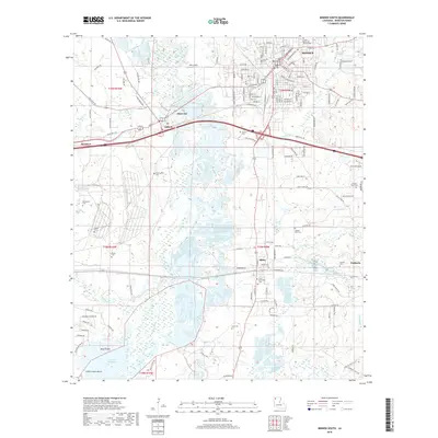
2018 Map of Minden South
USGS Topo · Published 2018About this map
Bayou Dorcheat meanders through the center of this Webster Parish landscape, shaping the geography between Minden and Sibley. The bottomlands and marshes north of Lake Bistineau are punctuated by named landmarks like Goat Island and Little Crane Island, reflecting the influence of the local waterway system on regional movement and land use. This area represents a crossroads of the Kansas City Southern railroad and major regional roads, connecting established communities like Dubberly and Dixie Inn. Numerous small family and memorial burial grounds are scattered across the terrain, including Fuller Memorial Shrine Cem and the more remote Knottingham Cem, providing essential points of reference for genealogical research. The map illustrates a developed rural landscape where residential streets in the southern portion of Minden give way to the sprawling natural drainages of Boone Cr and Brushy Cr.
Find a feature on this map
125 named features on this map. Tap any name to fly to it.
Don’t see what you’re looking for? This feature index may not catch every label — zoom into the map to look around manually.
Map Details
Editions of this 2018 Minden South Map
This is the sole edition of this map. No revisions or reprints were ever made.
Other maps of this area

1947 · Ringgold
USGS Topo · 1:62,500

1947 · Minden
USGS Topo · 1:62,500

1948 · Jamestown
USGS Topo · 1:62,500

1949 · Jamestown
USGS Topo · 1:62,500

1949 · Minden
USGS Topo · 1:62,500

1949 · Gibsland
USGS Topo · 1:62,500

1950 · Gibsland
USGS Topo · 1:62,500

1955 · Shreveport
USGS Topo · 1:250,000

1956 · Shreveport
USGS Topo · 1:250,000

1956 · Ringgold
USGS Topo · 1:62,500