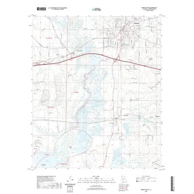
2020 Map of Minden South
USGS Topo · Published 2020About this map
Minden serves as the focal point of this survey, with the Webster Parish Courthouse anchoring the town center near several historical burial grounds like Minden Cem and Sheppard Cem. The landscape is defined by the winding course of Bayou Dorcheat, which flows southward through the center of the sheet towards Lake Bistineau. This waterway, historically a vital transport artery for Webster Parish, is flanked by smaller settlements such as Dixie Inn and Gifford, as well as an ancient Indian Mound located near the northern reaches of the lake.
Find a feature on this map
150 named features on this map. Tap any name to fly to it.
Don’t see what you’re looking for? This feature index may not catch every label — zoom into the map to look around manually.
Map Details
Editions of this 2020 Minden South Map
This is the sole edition of this map. No revisions or reprints were ever made.
Other maps of this area

1947 · Ringgold
USGS Topo · 1:62,500

1947 · Minden
USGS Topo · 1:62,500

1948 · Jamestown
USGS Topo · 1:62,500

1949 · Jamestown
USGS Topo · 1:62,500

1949 · Minden
USGS Topo · 1:62,500

1949 · Gibsland
USGS Topo · 1:62,500

1950 · Gibsland
USGS Topo · 1:62,500

1955 · Shreveport
USGS Topo · 1:250,000

1956 · Shreveport
USGS Topo · 1:250,000

1956 · Ringgold
USGS Topo · 1:62,500