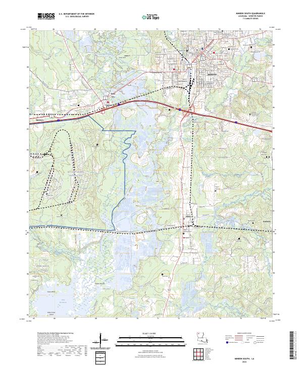
2024 Map of Minden South
USGS Topo · Published 2024About this map
The Webster Parish Courthouse stands as the civic heart of Minden, anchoring a landscape where North Louisiana's piney woods meet the sprawling wetlands of the Bayou Dorcheat basin. To the south, the expansive NG Camp Minden Training Site occupies a massive footprint between the bayou and the community of Dixie Inn, illustrating the region's long-standing connection to military infrastructure. The terrain transitions from the developed streets of the county seat to the ecological richness of Lake Bistineau, where Goat Island and Little Crane Island emerge from the water.
Find a feature on this map
146 named features on this map. Tap any name to fly to it.
Don’t see what you’re looking for? This feature index may not catch every label — zoom into the map to look around manually.
Map Details
Editions of this 2024 Minden South Map
This is the sole edition of this map. No revisions or reprints were ever made.
Other maps of this area

1947 · Ringgold
USGS Topo · 1:62,500

1947 · Minden
USGS Topo · 1:62,500

1948 · Jamestown
USGS Topo · 1:62,500

1949 · Jamestown
USGS Topo · 1:62,500

1949 · Minden
USGS Topo · 1:62,500

1949 · Gibsland
USGS Topo · 1:62,500

1950 · Gibsland
USGS Topo · 1:62,500

1955 · Shreveport
USGS Topo · 1:250,000

1956 · Shreveport
USGS Topo · 1:250,000

1956 · Ringgold
USGS Topo · 1:62,500