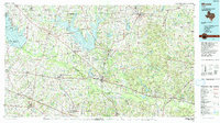
1991 Map of Mineola
USGS Topo · Published 1991About this map
The Sabine River basin defines this 1991 landscape, where massive water projects like the Lake Fork Reservoir and Lake Tawakoni have reshaped the Wood County terrain. The rail hub of Mineola sits at the junction of the Texas and Pacific Railroad and the Missouri Pacific Railroad, anchoring a network of smaller communities such as Bright Star, Golden, and Garden Valley. This edition documents the extensive energy infrastructure of the East Texas oil belt, specifically identifying broad Oil Fields and Oil and Gas Fields that neighbor agricultural lands.
Find a feature on this map
106 named features on this map. Tap any name to fly to it.
Don’t see what you’re looking for? This feature index may not catch every label — zoom into the map to look around manually.
Map Details
Editions of this 1991 Mineola Map
This is the sole edition of this map. No revisions or reprints were ever made.
Other maps of this area

1920 · Kemp
USGS Topo · 1:62,500

1936 · Kilgore
USGS Topo · 1:48,000

1938 · Winona
USGS Topo · 1:48,000

1940 · Kilgore
USGS Topo · 1:62,500

1943 · Winona
USGS Topo · 1:62,500

1948 · Tyler
USGS Topo · 1:62,500

1948 · Brownsboro
USGS Topo · 1:62,500

1948 · Martins Mill
USGS Topo · 1:62,500

1949 · Tyler
USGS Topo · 1:62,500

1949 · Martins Mill
USGS Topo · 1:62,500