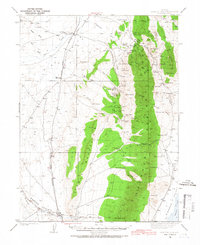
1937 Map of Mineral Hill
USGS Topo · Published 1967About this map
Sulphur Spring Range dominates the central landscape of this 1937 survey, where a high-desert mining and ranching economy is visible through its network of isolated outposts and springs. The settlement of Mineral Hill and the Old Whalen Mine highlight the era's subterranean extraction, while family-named holdings like the Plummer Ranch, Bruffey Ranch, and Alpha Ranch define the valley floors.
Find a feature on this map
66 named features on this map. Tap any name to fly to it.
Don’t see what you’re looking for? This feature index may not catch every label — zoom into the map to look around manually.
Map Details
Editions of this 1937 Mineral Hill Map
4 editions found
Other maps of this area

1926 · Roberts Mountains
USGS Topo · 1:250,000

1929 · Roberts Mountains
USGS Topo · 1:250,000

1934 · Jiggs
USGS Topo · 1:125,000

1937 · Mineral Hill
USGS Topo · 1:48,000

1937 · Jiggs
USGS Topo · 1:125,000

1943 · Mineral Hill
USGS Topo · 1:62,500

1949 · Garden Valley
USGS Topo · 1:62,500

1949 · Roberts Creek Mtn
USGS Topo · 1:62,500

1951 · Roberts Creek Mtn
USGS Topo · 1:62,500

1951 · Garden Valley
USGS Topo · 1:62,500