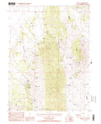
1986 Map of Mineral Hill
USGS Topo · Published 1986About this map
Mineral Hill Mines and the surrounding high-desert mining district dominate this mid-1980s landscape, illustrating a classic Nevada mineral extraction economy. The complex topography of the Sulphur Spring Range and Union Mountain is dotted with numerous mines, mineshafts, and open pits, including the prominent Bell mine. Settlement patterns are sparse, defined by remote outposts such as Plummer Ranch and Bruffey Ranch, while the area's limited water sources are marked by various springs, including Hot Springs and Warm Spring. Near the primary mining operations, a small Cem (cemetery) serves as a poignant reminder of the early prospectors and families who inhabited this arid region. The network of canyons, from Slaughterhouse Canyon to Bruffey Canyon, reveals the difficult access routes utilized by 20th-century miners and ranchers.
Find a feature on this map
62 named features on this map. Tap any name to fly to it.
Don’t see what you’re looking for? This feature index may not catch every label — zoom into the map to look around manually.
Map Details
Editions of this 1986 Mineral Hill Map
2 editions found
Other maps of this area

1934 · Jiggs
USGS Topo · 1:125,000

1937 · Mineral Hill
USGS Topo · 1:48,000

1937 · Jiggs
USGS Topo · 1:125,000

1943 · Mineral Hill
USGS Topo · 1:62,500

1952 · Pine Valley
USGS Topo · 1:62,500

1955 · Winnemucca
USGS Topo · 1:250,000

1955 · Elko
USGS Topo · 1:250,000

1956 · Robinson Mtn
USGS Topo · 1:62,500

1958 · Winnemucca
USGS Topo · 1:250,000

1958 · Elko
USGS Topo · 1:250,000