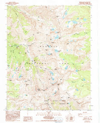
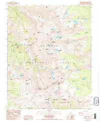
1988 Map of Mineral King
USGS Topo · Published 1993About this map
Mineral King serves as the focal point for this high-altitude survey of the southern Sierra Nevada, where the East Fork Kaweah River originates. The landscape is defined by the Great Western Divide and the intersection of the Sequoia National Park and Sequoia National Forest. Evidence of the region's late 19th-century silver mining boom is visible through the Empire Mine, Lady Franklin Mine, and the Chihuahua Mine, along with the Empire Mill (Ruins). This edition documents the area just before significant environmental protections were finalized, showing the transition from industrial extraction to a protected wilderness. Notable high-country waypoints include the Crabtree Cabin (Ruins) and the Cold Spring Campground, providing reference points for those tracing historical trails over Sawtooth Pass or through Farewell Gap into the Golden Trout Wilderness.
Find a feature on this map
75 named features on this map. Tap any name to fly to it.
Don’t see what you’re looking for? This feature index may not catch every label — zoom into the map to look around manually.
Map Details
Editions of this 1988 Mineral King Map
5 editions found
Other maps of this area

1903 · Tehipite
USGS Topo · 1:125,000

1904 · Kaweah
USGS Topo · 1:125,000

1905 · Tehipite
USGS Topo · 1:125,000

1905 · Olancha
USGS Topo · 1:125,000

1907 · Olancha
USGS Topo · 1:125,000

1907 · Mt. Whitney
USGS Topo · 1:125,000

1909 · Kaweah
USGS Topo · 1:125,000

1919 · Mt. Whitney
USGS Topo · 1:125,000

1937 · Mt. Whitney
USGS Topo · 1:125,000

1937 · Kaweah
USGS Topo · 1:125,000