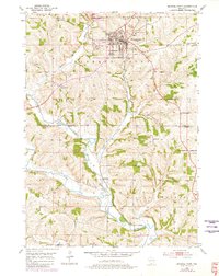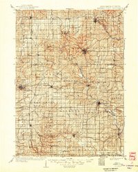
1902 Map of Mineral Point
USGS Topo · Published 1949About this map
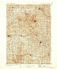
Mineral Point serves as the focal point for this expansive survey of the Driftless Area in Southwest Wisconsin and Northern Illinois at the turn of the century. The map illustrates a complex network of early transportation, where the Mineral Point and Northern Ry and the Chicago Milwaukee and St Paul Ry converge at Calamine and head north into the lead-mining district. To the south, the landscape is dotted with small rural communities like New Diggings, Meekers Grove, and Elk Grove, revealing the dense settlement patterns of late-19th-century mining and farming families before modern agricultural consolidation.
Find a feature on this map
93 named features on this map. Tap any name to fly to it.
Don’t see what you’re looking for? This feature index may not catch every label — zoom into the map to look around manually.
Map Details
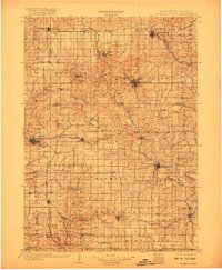
Editions of this 1902 Mineral Point Map
4 editions found

Historical Maps of Platteville Through Time
7 maps found