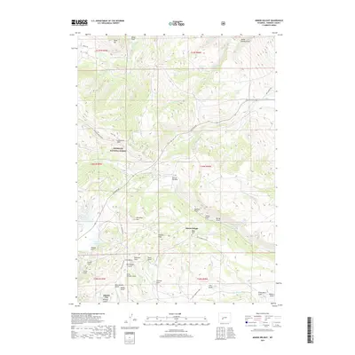
2017 Map of Miners Delight
USGS Topo · Published 2017About this map
Miners Delight and the nearby Atlantic City settlement occupy a high-elevation landscape defined by the legacies of Wyoming mining history within the Shoshone National Forest. The map detail reveals an intricate network of drainages and gulches, including Big Atlantic Gulch, Placerita Gulch, and Beer Garden Gulch, which suggest the historic gold-seeking activity of the South Pass region. High ground is marked by prominent features like Peabody Ridge and Limestone Mtn, while the Miners Delight Cem serves as a quiet record of the individuals who once inhabited these camps. Transportation history is visible through the Fort Stambaugh Loop and the Indian Trl, connecting this mountain terrain to the broader regional history of the 19th-century frontier. This 2017 survey provides a clear view of the modern topography while preserving the names of the gulches and springs that once supported a thriving mining economy.
Find a feature on this map
60 named features on this map. Tap any name to fly to it.
Don’t see what you’re looking for? This feature index may not catch every label — zoom into the map to look around manually.
Map Details
Editions of this 2017 Miners Delight Map
This is the sole edition of this map. No revisions or reprints were ever made.
Other maps of this area

1953 · Gravel Spring
USGS Topo · 1:24,000

1953 · Radium Springs
USGS Topo · 1:24,000

1953 · Atlantic City
USGS Topo · 1:24,000

1953 · Fossil Hill
USGS Topo · 1:24,000

1953 · Louis Lake
USGS Topo · 1:24,000

1953 · South Pass City
USGS Topo · 1:24,000

1953 · Weiser Pass
USGS Topo · 1:24,000

1954 · Wolf Point
USGS Topo · 1:24,000

1954 · Miners Delight
USGS Topo · 1:24,000

1955 · Lander
USGS Topo · 1:250,000