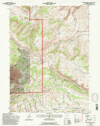
1991 Map of Miners Delight
USGS Topo · Published 1997About this map
Miners Delight and the surrounding terrain of the Shoshone National Forest define this 1991 revision of a classic mining district. The landscape is heavily marked by gold mining history, with numerous operations including the Garfield Mine, Caribou Mine, and Gold Dollar Mine situated among the gulches and ridges. Significant industrial activity is represented by the Columbia-Geneva Mines, while the presence of the Miners Delight historical site and a nearby Cemetery provides a focal point for genealogical research. The high country terrain ranges from Limestone Mountain to Roundtop Mountain, intersected by a network of drainage systems like Beaver Creek and Yankee Gulch. Evidence of early military and ranching history is preserved through labels for Fort Stambaugh and the Beaver Creek Counting Pens, showing a multifaceted history of resource extraction and frontier settlement.
Find a feature on this map
55 named features on this map. Tap any name to fly to it.
Don’t see what you’re looking for? This feature index may not catch every label — zoom into the map to look around manually.
Map Details
Editions of this 1991 Miners Delight Map
This is the sole edition of this map. No revisions or reprints were ever made.
Other maps of this area

1953 · Gravel Spring
USGS Topo · 1:24,000

1953 · Radium Springs
USGS Topo · 1:24,000

1953 · Atlantic City
USGS Topo · 1:24,000

1953 · Fossil Hill
USGS Topo · 1:24,000

1953 · Louis Lake
USGS Topo · 1:24,000

1953 · South Pass City
USGS Topo · 1:24,000

1953 · Weiser Pass
USGS Topo · 1:24,000

1954 · Wolf Point
USGS Topo · 1:24,000

1954 · Miners Delight
USGS Topo · 1:24,000

1955 · Lander
USGS Topo · 1:250,000