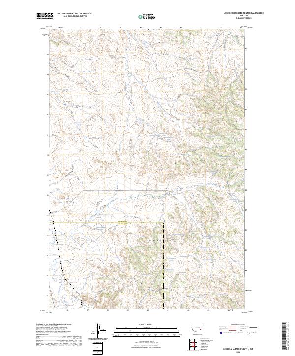
2024 Map of Minnehaha Creek South
USGS Topo · Published 2024About this map
The Little Wolf Mountains dominate this high-plains landscape where the southern border of Treasure County meets Big Horn County. This area is defined by a dense network of seasonal drainages and named coulees that feed the larger watercourses of Sarpy Creek and Horse Creek. The map reveals a land utilized for large-scale ranching and grazing, characterized by numerous spring-fed stock watering points, such as 02N38E30BBCA01 Spring and 03N37E36CDDA01 Spring. The isolation of the terrain is bridged by a sparse road network, including Horse Creek Rd and Wilson Rd, which follow the natural contours of the drainages. Researchers will find a meticulously surveyed environment where every named coulee, like Willoughby Coulee and Bar Coulee, marks the critical hydrology of the Montana grasslands.
Find a feature on this map
37 named features on this map. Tap any name to fly to it.
Don’t see what you’re looking for? This feature index may not catch every label — zoom into the map to look around manually.
Map Details
Editions of this 2024 Minnehaha Creek South Map
This is the sole edition of this map. No revisions or reprints were ever made.
Other maps of this area

1954 · Hardin
USGS Topo · 1:250,000

1954 · Forsyth
USGS Topo · 1:250,000

1957 · Hardin
USGS Topo · 1:250,000

1957 · Forsyth
USGS Topo · 1:250,000

1958 · Forsyth
USGS Topo · 1:250,000

1958 · Hardin
USGS Topo · 1:250,000

1971 · Mc Clure Creek
USGS Topo · 1:24,000

1971 · Griffin Coulee SW
USGS Topo · 1:24,000
1971 · Sarpy School
USGS Topo · 1:24,000

1972 · Minnehaha Creek South
USGS Topo · 1:24,000