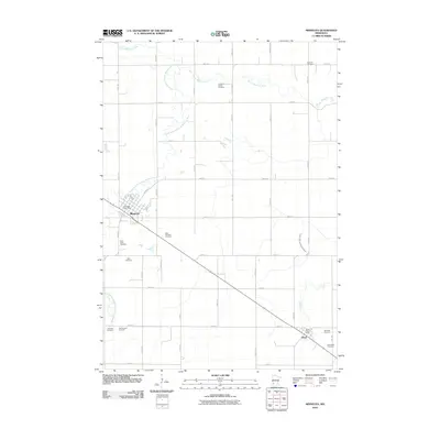
2010 Map of Minneota
USGS Topo · Published 2010About this map
Minneota and Ghent anchor this prairie landscape in Lyon County, where the agricultural grid is defined by numbered avenues and streets. The heritage of the region's settlers is visible in the numerous burial grounds scattered across the township, including the Icelandic Cemetery in the northeast and the Josephson Family Cemetery near the Yellow Medicine River. This river, along with the South Branch Yellow Medicine River, provides the primary natural drainage through a landscape otherwise dominated by straight-line roads and managed waterways like County Ditch Number Sixtythree.
Find a feature on this map
37 named features on this map. Tap any name to fly to it.
Don’t see what you’re looking for? This feature index may not catch every label — zoom into the map to look around manually.
Map Details
Editions of this 2010 Minneota Map
This is the sole edition of this map. No revisions or reprints were ever made.
Other maps of this area

1953 · Watertown
USGS Topo · 1:250,000

1953 · New Ulm
USGS Topo · 1:250,000

1957 · New Ulm
USGS Topo · 1:250,000

1958 · New Ulm
USGS Topo · 1:250,000

1958 · Watertown
USGS Topo · 1:250,000

1963 · Gislason Lake
USGS Topo · 1:24,000

1963 · Lynd
USGS Topo · 1:24,000

1963 · Marshall
USGS Topo · 1:24,000

1967 · New Ulm
USGS Topo · 1:250,000

1967 · Minneota
USGS Topo · 1:24,000