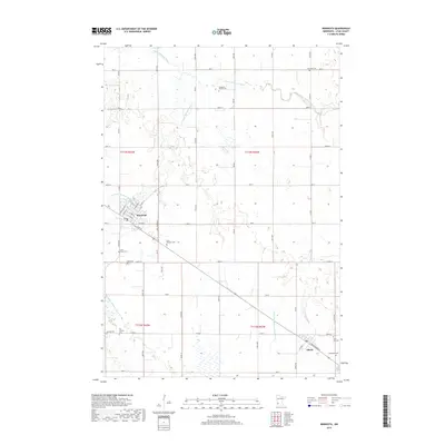
2019 Map of Minneota
USGS Topo · Published 2019About this map
Minneota and Ghent anchor this western Minnesota landscape, characterized by a grid of agricultural section lines and the winding course of the Yellow Medicine River. The river and its tributaries, including the S Br Yellow Medicine River, carve subtle drainage patterns through the Lyon County prairie. This 2019 survey reveals a significant density of genealogical sites, particularly the numerous family and denominational burial grounds scattered across the townships.
Find a feature on this map
47 named features on this map. Tap any name to fly to it.
Don’t see what you’re looking for? This feature index may not catch every label — zoom into the map to look around manually.
Map Details
Editions of this 2019 Minneota Map
This is the sole edition of this map. No revisions or reprints were ever made.
Other maps of this area

1953 · Watertown
USGS Topo · 1:250,000

1953 · New Ulm
USGS Topo · 1:250,000

1957 · New Ulm
USGS Topo · 1:250,000

1958 · New Ulm
USGS Topo · 1:250,000

1958 · Watertown
USGS Topo · 1:250,000

1963 · Gislason Lake
USGS Topo · 1:24,000

1963 · Lynd
USGS Topo · 1:24,000

1963 · Marshall
USGS Topo · 1:24,000

1967 · New Ulm
USGS Topo · 1:250,000

1967 · Minneota
USGS Topo · 1:24,000