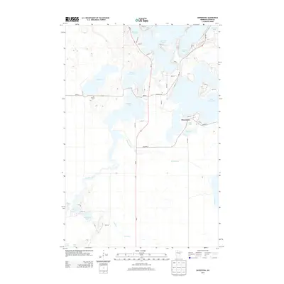
2013 Map of Minnewawa
USGS Topo · Published 2013About this map
Big Sandy Lake and its intricate northern shoreline dominate this portion of Aitkin County, where the landscape is defined by an extensive network of interconnected waterways and marshy basins. The settlement of Minnewawa sits near the eastern shore of Dollar Lake, serves as a focal point for local transit along MN-65. This corridor bisects the map vertically, passing between Lakeview Cem and Shamrock Cem, which provide historical touchstones for the community.
Find a feature on this map
41 named features on this map. Tap any name to fly to it.
Don’t see what you’re looking for? This feature index may not catch every label — zoom into the map to look around manually.
Map Details
Editions of this 2013 Minnewawa Map
This is the sole edition of this map. No revisions or reprints were ever made.
Other maps of this area

1953 · Duluth
USGS Topo · 1:250,000

1958 · Duluth
USGS Topo · 1:250,000

1969 · Lawler
USGS Topo · 1:24,000

1970 · Kimberly
USGS Topo · 1:24,000

1970 · Mc Gregor
USGS Topo · 1:24,000

1970 · Tamarack
USGS Topo · 1:24,000

1970 · Palisade
USGS Topo · 1:24,000

1970 · Sanders Lake
USGS Topo · 1:24,000

1970 · Balsam
USGS Topo · 1:24,000

1970 · Libby
USGS Topo · 1:24,000